Himalayan vulnerability is not a random misfortune of geography but a compounding function of rapid tectonic convergence and accelerating thermal anomalies. When infrastructure collapses or valleys flood in Nepal, public discourse typically defaults to surface-level explanations blaming heavy monsoon rains or fragile soil. That diagnostic framework is insufficient. The actual risk architecture relies on a strict sequence of geomorphic tipping points: unmitigated glacial mass loss, unstable moraine dam hydraulics, and hyper-accelerated road engineering cutting through weak orogenic suture zones.
Understanding this system requires looking past the weather report and examining the underlying physical variables. The vulnerability of the region stems from three interlocking mechanisms: rapid cryospheric degradation creating Glacial Lake Outburst Floods, continuous orogenic uplift producing high-frequency mass wasting, and human settlement patterns structurally misaligned with these geological hazard rates.
The Cryospheric Driver and Glacial Lake Mechanics
The primary hydrological threat originates above 4,000 meters, where rising atmospheric temperatures alter the mass balance of glaciers. As clean-ice and debris-covered glaciers retreat, they leave behind massive depressions bounded by terminal and lateral moraines—mounds of unsorted gravel, sand, and boulders pushed forward during centuries of historical advance.
These moraines do not function as engineered concrete dams. They are loose aggregates of debris stabilized only by internal ice cores. As global mean temperatures rise, these internal ice cores melt, creating internal voids and seepage pathways. Simultaneously, the volume of meltwater accumulating behind these unstable barriers increases exponentially, forming expansive proglacial lakes.
The hydraulic pressure exerted on a moraine wall scales with the square of the water depth. When meltwater accumulation outpaces natural drainage or evaporation, the margin of safety shrinks rapidly. A trigger event—such as an ice avalanche plunging into the lake, a severe seismic tremor, or sudden heavy precipitation—displaces a massive volume of water, generating an impulse wave. This wave overtops the moraine crest, initiates rapid erosion of loose sediment, and causes catastrophic failure of the natural dam.
The resulting Glacial Lake Outburst Flood releases millions of cubic meters of water and debris in a matter of hours. The downstream impact is catastrophic because the topography funnels this energy into narrow gorges before it hits populated, low-gradient river valleys. The energy of the flood does not dissipate gradually; instead, it transforms into a hyper-concentrated debris flow that strips vegetation, destroys bridges, and obliterates hydroelectric infrastructure located too close to the riverbed.
Tectonic Instability and Mass Wasting Economics
While glacial outburst floods represent sudden hydrological shocks, continuous orogenic movement drives chronic background risk. The Himalayas remain one of the most dynamic collision zones on Earth, formed by the ongoing subduction of the Indian Plate beneath the Eurasian Plate. This tectonic convergence drives an average uplift rate of several millimeters per year, accompanied by frequent seismic adjustments.
This constant geological activity fractures the bedrock, leaving mountainsides in a state of marginal stability. Rock slopes and soil mantles are heavily jointed and weathered. Consequently, any disruption to the toe of a slope—whether from river incision at the base or human excavation higher up—readily triggers landslides and debris flows.
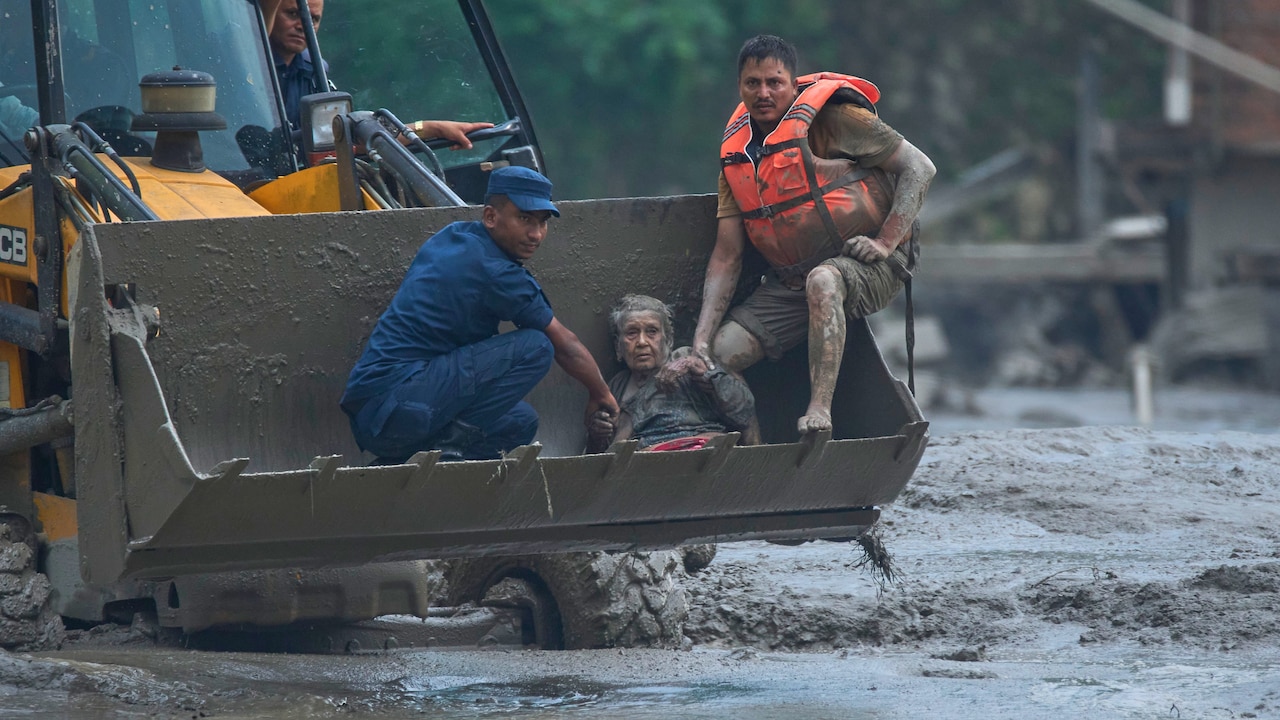
The economic cost of this tectonic instability is compounded by linear infrastructure development. Road expansion projects across the middle hills of Nepal frequently employ unengineered cut-and-fill techniques. Bulldozers carve roads directly into steep, unstable slopes, dumping excavated spoil material downslope where it destabilizes vegetation and clogs local drainage channels. During the monsoon season, this loose spoil material liquefies, turning minor rain events into destructive mudslides that isolate mountain communities and sever economic lifelines.
The mismatch between geological timescales and human planning horizons drives the persistence of this crisis. Geological systems operate on cycles of centuries and millennia, reacting to tectonic stress and climatic shifts with massive inertia. Human development cycles operate on municipal election terms or short-term infrastructure amortization schedules. When roads and bridges are rebuilt using historical weather parameters rather than projected hazard frequencies, capital is systematically misallocated into assets designed to fail under the next major climatic or seismic stress test.
Risk Mitigation and Strategic Infrastructure Realignment
Addressing systemic vulnerability requires shifting from reactive disaster response to proactive risk avoidance. Traditional engineering solutions, such as attempting to armor unstable slopes with concrete retaining walls or draining individual glacial lakes via artificial channels, offer only localized and temporary relief. The scale of the orogenic system renders brute-force geo-engineering economically unviable and physically impractical.
Effective adaptation demands a fundamental reallocation of capital toward spatial planning and structural relocation. Critical infrastructure, including major hydropower installations, transmission lines, and permanent settlements, must be removed from high-hazard zones such as active alluvial fans, narrow river corridors, and toe-of-slope locations prone to rapid mass wasting.
Furthermore, early warning systems must be integrated directly with automated operational controls. Downstream sensor arrays monitoring lake levels and seismic activity should not merely trigger sirens for human evacuation; they must automatically shut down water intakes for hydropower facilities, divert traffic away from vulnerable bridges, and isolate damaged power grids to prevent secondary hazards.
The long-term resilience of mountainous developing regions depends entirely on treating geography as an active, non-negotiable constraint rather than a passive backdrop for development. Capital expenditure programs that ignore the combined velocity of tectonic uplift and cryospheric retreat will continue to subsidize high-frequency infrastructure destruction. The strategic imperative is clear: restrict permanent high-value asset concentration within active hazard corridors, mandate engineered slope stability standards for all linear infrastructure, and price systemic geological risk directly into every development loan and municipal budget.